You’ve probably seen the name ‘Venice of the North’ many times. It’s a famous name of Amsterdam, mainly used in guides. It’s was invented because the city has dozens of canals with a total length of more than 100 kilometers. However, is it true that Amsterdam was built on water? Is it possible at all?
Yes – Amsterdam was built on water. More substantively, the city was built on piles – large wooden stakes that are driven into the ground. The piles (or the stilts) are driven in the clay, pear and water until they reach the first layer of solid sand. They are literally a foundation for all Amsterdam’s buildings.
This article explains in details, why it’s said that Amsterdam is built on water. It elaborates more on the piling system that was developed in early times. As it’s connected with the history of the city, I have also decided to subsume the history of Amsterdam here. Because the number of canals around and inside the city is great, the canals are also a relevant part of this post.
How Come Amsterdam Is on Water?
It’s all about the technique that the Dutch people used for ages – piling. Hundreds years ago, the oak logs were used, currently the concrete piles are preferred. The piles should reach boulder clay or, at most cases, a more stable layer of soil. Such layers are somewhere around 15-25 meters (the first 10 meters are just peat and soft clay) in Amsterdam, the boulder clay is somewhere around 60 meters. One might say that Amsterdam was literally built on stilts. They laid the foundation for every building in the city (for instance, in order to hold up Central Station more than 6,000 piles was needed). You should know that the most shallow layers of soil in Amsterdam are almost 100% water-saturated so if you don’t use the piling technique, the building won’t be stable enough. Small constructions and roads can actually work even if a layer of sand and pavement put on top of the soil. However, bigger structures like high buildings or motorways need to be built with piling. Otherwise, they would probably crash. Currently, large buildings in Amsterdam are attached to the layer of boulder clay at around sixty meters. Obviously, piles are being maintained on a regular basis so that they stay in load-bearing condition.
History of Amsterdam
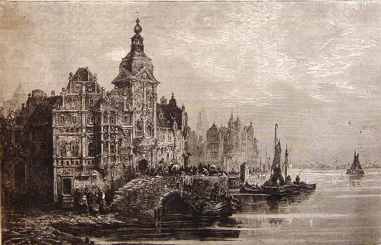
Amsterdam, probably one of the greatest planned cities in the world, began as a village on the River Amstel, inhabited by a tiny community of herring fishermen. During the 12th century, the fisherman living by the river wanted to prevent his home against flooding. Thus, he built a dam and this led the city to be called Amsterdam (for the first time the name Amstelledamme was used October 27th, 1275 in the toll concession of Count of Holland – Floris V). In the Middle Ages, the town became a center of trade. In 1306, Amsterdam received certain rights by the bishop of Utrecht. Approximately 50 years later, the town joined the Hanseatic League.
The Golden Age
Amsterdam suffered a very serious fire in 1421, then again in 1452. As most buildings were made of wood, both fires caused severe consequences. This didn’t stop the development though. During the 15th century, Amsterdam underwent rapid growth. During that time, many amazing medieval buildings were built (like the Old and New Churches). However, many of them were destroyed, not only by fires but also the Eighty Years’ War. In 1578, the town supported William I of Orange, also the Dutch uprising took place. The uprising led to the Eighty Years’ War – it ended in 1648 with the final declaration of independence of the Dutch Republic. Despite the unrest, the Golden Age was Amsterdam’s huge success.
How Did the City Change
You can say that the town was the staple market of the whole world. In 1602, Amsterdam became the headquarters of the Dutch East India Company, and became the site of the world’s first stock exchange at the same time. In 1609, one of the earliest banks were founded there. The cityscape developed – among the others, some famous buildings appeared: the town hall in the Dam Square, the Westerkerk and many canal houses. Many immigrants came to Amsterdam and the population rose to 200,000. The city of Amsterdam became home for e.g. Spinoza, Rembrandt and Descartes. However, by the end of the 17th century, Amsterdam lost its political power to The Hague and then, because of the conflicts against England, France and Prussia, the Golden Age ended.
The Recession and the Recovery
In 1672, both French and English troops attacked the country. The Batavian Republic is installed. After Napoleon invaded the country, Amsterdam became a capital of the Netherlands. Between the 18th and 19th centuries, the city suffered from the economic recession. The rapid economic recovery occurred between the years 1813 and 1940. In fact, the whole country started its expansion. There was a quickly-rising population growth, the wealth level increased. In Amsterdam, a railway to Haarlem was built and the Industrial Revolution caused a transformation of the city and made Amsterdam experience another Golden Age. Many new buildings were erected (the Rijkmuseum, Central Station, the Rembrandt House). The city expanded greatly, many new canals were constructed and the North Sea Canal is dug. Thanks to Central Station’s grand debut, the city finally started being connected by rail to the rest of Europe.
World War I and World War II
The Netherlands was neutral during World War I (but food shortages crippled the country which led to strikes). However, the Nazi Germans invaded the country in 1940 after the World War II started. Surprisingly, Amsterdam suffered only minor damage before capitulation. Around 100,000 of the Jewish people in Holland were deported, many were persecuted. Probably the most famous victim is Anne Frank, a Jewish woman who was hiding in Amsterdam for two years. The period of 1920 – 1940 is definitely a time of economic recession.
Nowadays
Even if Amsterdam has lost its position of the most important harbor and the economic capital of the country, it’s still a major industrial city. Schiphol Amsterdam is the biggest Dutch airport and Amsterdam is definitely the most famous city when it comes to culture, tolerance and freedom.
The Amsterdam Canals
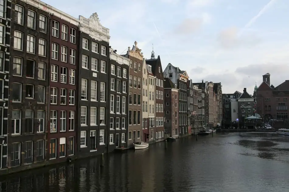
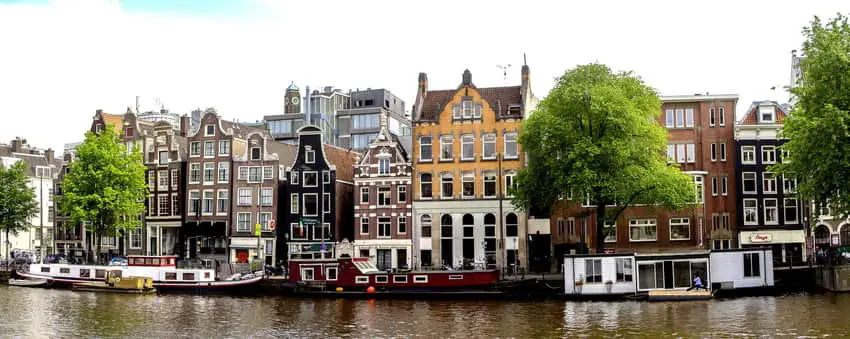
Amsterdam is very often recognized as a city of canals. In total there are 165 canals and their length is around 100 kilometers. Four of them are the most popular: Prinsengracht, Singel, Keizersgracht and Herengracht. They form a concentric belt around the old city. Amsterdam’s canals were listed as UNESCO World Heritage Site in 2010.
The Herengracht
The first canal in Amsterdam. It’s also the most elegant one. The Herengracht was named after a body of Lords who governed the city (in Dutch they were called heren regeerders).
The Kaizersgracht
It was built as the second canal in Amsterdam. The Kaizersgracht was named after the Holy Roman Emperor – Maximilian I.
The Singel
It was built in the Middle Ages. The Singel, currently the inner-most canal in the city, runs from the IJ bay, behind Central Station to the Mountplein square.
The Prinsengracht
The Prinsengracht is the longest canal in the city.
Why Does Amsterdam Have So Many Canals
As it was mentioned above, the area Amsterdam was built on used to be quite boggy. The ground was drained all the time. Thus, many small islands was created. They were surrounded by canals. Most of them were built in the 16th and 17th centuries. The canals were man-made.
The History of Amsterdam’s Canals
It all dates back to the 17th century. It was known as the Golden Age of the Netherlands. As the city was known for its economic, political and cultural prosperity, more and more immigrants were moving to Amsterdam. The city government had to solve the lack of space. This is the main reason canals were dug in 16th century. However, the fourth canal – the Singel – was built and used for defense, transport and water management.
Are Canals Used Now?
Of course. They are still used for navigation and recreational purposes – like parades and events. Actually, they are also used for habitation (just think about Amsterdam’s floating houseboats!). The canals contain both salt water and fresh water. The fresh water flows from the river Rhine and the salt water comes via the Noordzeekanaal. Unfortunately, swimming is not allowed in the canals. They are cleaned three times a week (the canal gates are opened and the water is refreshed), that’s true, but swimming is forbidden as it’s not considered to be safe. However, you can still admire them during a canal cruise or from one of the bridges. The average depth of the canals is between 2 and 3 meters.
A Quick Wrap Up
You cannot be surprised that Amsterdam is totally flat. It was built on piles after all. 100 kilometers of picturesque canals, amazing bridges, beautiful houses that was erected in the 17th century – all those makes Amsterdam an exceptional city. The history of canals is inseparably connected with the history of the city itself. They are a huge part of Amsterdam’s historical legacy. So, if next time anyone asks you if it’s true that Amsterdam is a city that was built on water, you can certainly say ‘yes’.