Amsterdam was built on peat, clay and the overlay intrusive North Sea. Very often it is said that the city is sinking into the North Sea. ‘Is Amsterdam below sea level?’ – many people ask and the question makes perfect sense as about half of the country lies below sea level. Some places even by several feet!
Yes. Amsterdam is below sea level, just like the half of the Netherlands. The city is situated around 2 meters below sea level and the lowest point in the Netherlands is almost 7 meters below sea level. The lowest parts of the country are the western parts of the Netherlands – Noord-Holland, Zuid-Holland, and Zeeland.
Holland works hard to keep Amsterdam as above sea level as possible. There are many systems preventing floods, many dikes and dunes are enforced every year. This will definitely continue in the coming years. In the article, I will try to elaborate more on Amsterdam’s location, as well as the prognoses I have heard.
How Come the Netherlands Is Below Sea Level
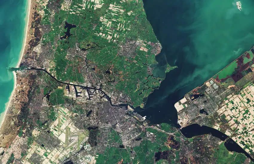
The problem didn’t actually exist around two thousand years ago. However, sea levels have been rising for ages and the areas Holland is situated became quite swampy. In the 12th and 13th centuries, people were just digging ditches and then, they were removing the water from the lowest places – they pumped it with windmills. It caused poor consequences in the future though. The ground level started to get lower because the water had been taken away. The process continued for many centuries and now there are some parts of Holland that are below sea level Noord-Holland, Zeeland and Zuid-Holland), just like Amsterdam. It’s actually more than half the land! This area is home to approximately 60% of the country’s population of around 16 million people. An average elevation in the Netherlands is 11 meters. Unfortunately, this makes Holland vulnerable when it comes to flooding.
Some More Facts About the Country Location
The lowest part is near the town Gouda – around 7 meters below sea level in Nieuwekerk aan den Ijssel. On the other hand, the highest point in the whole country is the tri-border area (a place where the Netherlands, Belgium, and Germany meet) – 323 meters above sea level. The mainland is very rich in water. Almost 20% of the total surface consists of water. Around 75% of the coastline is made out dunes (the total length of the coastline if 230 kilometers). Sometimes they are several-kilometer wide. On the contrary, the motorways are around 6,000-kilometer long in total.
Dutch Water Management Systems
What’s quite interesting, two major airports in the Netherlands are below sea level – Schiphol Airport and Rotterdam the Hague Airport. Some time ago, I didn’t understand why there is a whole government department devoted to managing water in the Netherlands. However, it seems that they work on many interesting innovations (like the enormous surge barriers in Rotterdam). The annual program (Delta Program) has been brought to life more than 10 years ago. It consists of sluice gates, dams and storm surge barriers. The aim of the program is to protect the country against floods. Many experts of water management, as well as authorities and civil society, are part of the Delta Program. The main vision behind the program is to both protect people from water-related natural disasters and also make living with the water more possible. The whole concept is called ‘room for the rivers’ and it totally changed the way experts were thinking. Instead of fighting with the risk of flooding, the aim is to give more space to the water. Rivers can expand when large volumes of water are entering the country. The next step is to dampen the development process in polders (low-lying areas of land reclaimed from the sea), as well as develop better early warning systems.
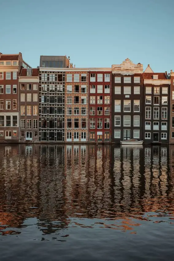
Why Are Parts of Amsterdam Below Sea Level
The answer is actually quite simple. In the 12th century, the fishing community settled along the river Amstel. The area was slightly above sea level. This was a perfect location for fishing boats. What is more, it was easier for fisherman to sell the fish they caught. However, the area along the river was prone to floods as there was a saltwater inlet. The fishing community was doing their best to fight against floods but not every fight was successful. Still, they didn’t want to move because while compared pros and cons of the locations, there were more advantages. Periodic floods occurred for many years and this is why many canals were built (most of them in the 16th century). All those works against inundation caused that Amsterdam moved a bit lower. Currently, it’s located almost 2 meters under sea level. All those resulted in how buildings in Amsterdam are constructed. The foundations have to rest upon the sand layers (and those old sand layers are located below the newer, higher layers). Cutting a long story short, the newer layers are drying out which causes a sinking of the ground level. This is the simplest explanation of why some parts of Amsterdam have been lowering.
And Schiphol?
Schiphol airport is 1 meter under sea level. It’s located at the bottom of what was Haarlemmer Lake before. The lake was actually drained in 1852 and the airport was technically built much more than 50 years later. However, you can still say that Schiphol is at the bottom of the lake. The deepest point of it lies around 4 meters below sea level. The whole airport lies approximately 1 meter under sea level. Isn’t it cool that the Amsterdam’s airport is one of the most low-lying airports in the whole world? This must be quite interesting for pilots, don’t you think?
Hudde’s Stones
Have you ever heard of the Huddesteen? Those are eight marble stones creating a monument in Amsterdam. They were named after a former mayor of Amsterdam (between 1672 and 1703) and a civil engineer at the same time – Johannes Hudde. It was his idea to build the monument that would mark the high water levels. This way, the builders could prevent the worst scenarios of flooding. Later on, the Huddesteen were transformed into the Amsterdam Ordnance Datum. The building is now a marker used to measure water levels (not only in the Netherlands, but in the whole Europe).
Floods in the Netherlands
As mentioned above, Holland has always been developing water management systems. Otherwise, the risk of flooding would overwhelm even larger parts of the country. However, even despite the proper care, there were several serious floods that affected the country very strongly. One of them took place in 1287 in the north. It completely ruined the northern areas and, at the same time, led to forming Zuiderzee. Another catastrophic flood happened in 1953 in southern provinces (the flood also affected Belgium, England and Scotland). Almost 2,000 Dutch people died, mostly in the province of Zeeland. After that, the government started to drain Zeeland which led to creating Flevoland province.
Are Dutch People Worried About Floods?
Not really. For many ages, they have been developing innovative systems of dunes, dykes, canals and barrages – all these makes the Netherlands stay above water. They even have 26 water boards (Waterschappen) to maintain and manage the whole system. The water boards are fully responsible for so-called water management. First of all, they check the level of water on a regular basis. If necessary, they also adjust the level by pumping out water to the higher canals. Sometimes they also pump it to the rivers running directly to the sea. This whole extensive system keeps the country safe. This actually explains why the Netherlands is not completely under water yet. The Dutch system is probably the most sophisticated (or almost sophisticated) anti-flood and water management system in the whole world. Besides flood protection, the systems also pride various economic and ecological benefits.
What Are the Prognoses?
Recently, an interview with the engineer who created the construction of the Oosterscheldekering (it protects the southwestern part of the country) has been published. The man said that although the dam was built in the 1970s, it can even last the next 200 years. However this is almost impossible when you think about ice sheets melting off, greenhouse gases and climate changes. It was proved by scientists (some of them are from Utrecht) that two-degree increase of Earth’s temperature will move the sea level by around 15 meters in the next few thousand years. We cannot see any severe results in the next 5-10 years but the process seems to be unstoppable, even if the time scale is centuries-millenniums there.
What’s In for the Netherlands
The country will probably disappear below sea level someday. It will not happen tomorrow or in a year, but it seems that it’s inevitable because of global warming. The southern parts of the country are built on soil that contains clay and peat. This is why towns like e.g. Gouda suffers from sinking ground. Such towns see the consequences of subsidence. It’s been estimated that the ground there sinks by at least 3 millimeters every year. What are the results to occur the earliest? Those might be, among the others, the following: cracked walls, uneven doorsteps, dry summers, large emissions of CO2 and the extraction of natural gas. Research shows that such damages can be even estimated to cost around 22 billion Euro until the year 2050, especially in Dutch rural areas and big cities.
Unfortunately, the Netherlands Center for Geodesy and Geo-informatics claim that the country has been sinking faster than previously thought. The worst scenario for the coming years is that we’ll reach around 2 meters of sea level in the second half of the century. In fact, a few years ago (in 2015) Holland became the first country in the world to have a court ruling on greater climate change mitigation efforts. Since then, the Netherlands is supposed to cut its emissions by at least 25% by 2020. The original plan was to reduce it by not even 17%.
Wrap up
Holland’s situation is much more serious one could think. Climate changes, emission etc. may cause that the country will literally disappear under water. I hope the article has shedded light upon that issue for you. Here are some final key points to remember:
- Parts of Amsterdam are below sea level, but not the whole city.
- The lowest point is Schiphol airport located at the bottom of former Haarlem Lake.
- Half of the country is below sea level – the lowest point is Nieuwekerk aan den Ijssel.
- Over the centuries people in the Netherlands have developed many innovative systems and programs to prevent floods. They have even managed to rise some provinces out of the sea. 26 dedicated water boards manage the whole system.
- The prognoses for Holland aren’t very optimistic – in some areas the ground have been sinking 3 millimeters (or even more) each year.